In and Out of Waimanalo in the Early Days
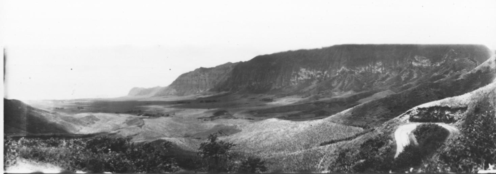
Gaining access to Waimanalo, in the days before cars and roads, was difficult at best. Although the above photo resembles the Pali hairpin turn, look closely and you will see that it is taken from the top of Aniani Nui Ridge. Aniani Nui Ridge separates Waimanalo from Maunawili. The steep and windy dirt road over Aniani Nui Ridge was never paved, and it was a carriage road in this photo. It fell into disuse once Kalanianaole Highway was built in the 1920s. At an earlier time, the road would have been a walking trail up and over the ridge.
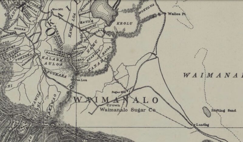
The two images below, closeups of an 1881 Map of O`ahu, show a windy path from the Nu`uanu Pali into Waimanalo. In those days, one went over the Pali from Honolulu, turning right onto Auloa Road at the base of the Pali, continuing through Maunawili, and then up and over the Aniani Nui Ridge into Waimanalo. The road then continued on to the Waimanalo Sugar Mill and then to the Waimanalo Landing, where the processed sugar was loaded onto a steamer twice weekly.
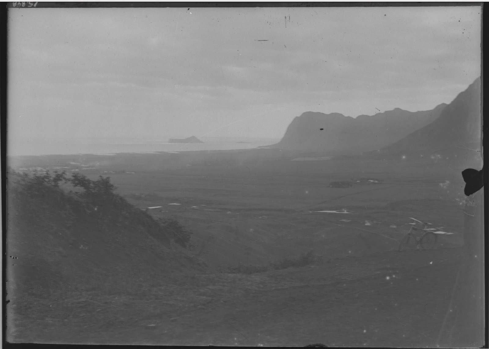
Look closely at the image below. It is another old photograph of Waimanalo from Aniani Nui ridge. The photographer seems to have been on a bicycle, which can be seen towards the photo’s right hand edge.
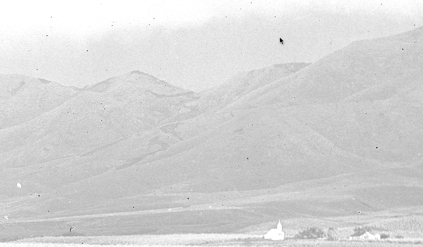
The photograph below is also of Aniani Nui Ridge in Waimanalo. Look closely and you can just make out what looks to be an old trail up and over Aniani Nui Ridge at a low point.
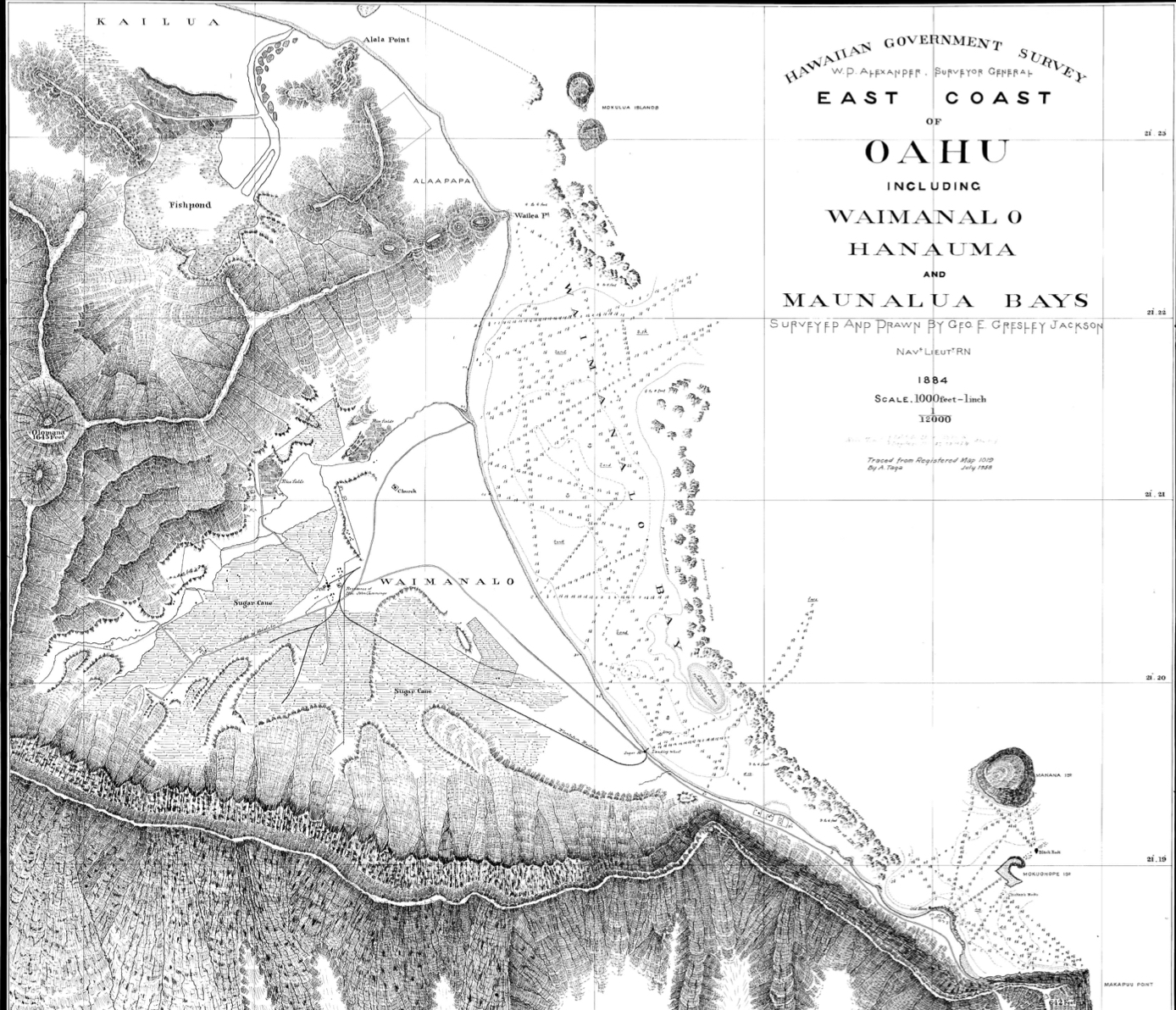
The map below, printed in 1884, shows the great extent of the Waimanalo Sugar Plantation. The early plantation workers were of Chinese descent, and rice fields can be seen towards the north edge of Waimanalo, where early Hawaiians once grew taro. The northeast portion of Waimanalo remained unplanted because the sandy soil there was unsuitable for growing sugarcane. That area later became Bellows Airfield. The mill, which began grinding cane in 1881, is just left of center on the map. What looks to be “roads” are mostly temporary railroad tracks, used to take the cane to the mill and the sugar to the pier.
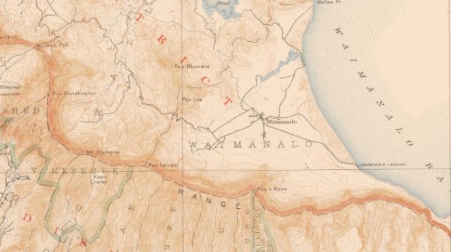
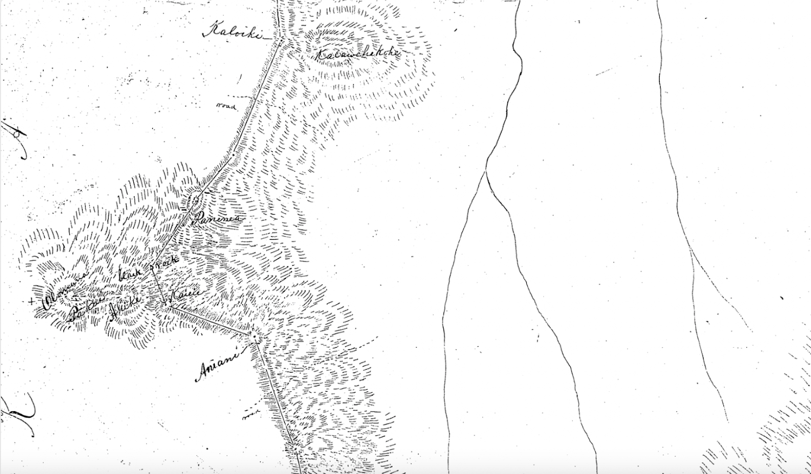
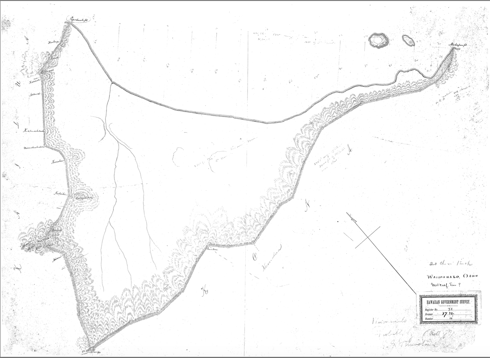
The two images below are both of an undated map of Waimanalo. The top image is a close up of the bottom image. The map shows a fairly empty Waimanalo, but the Waimanalo Stream is there, and the peaks of the mountains and ridges are named, although some are blurry. The image is interesting in that it depicts two “roads” up and over Aniani Nui Ridge, represented by a dotted line and the word “road”. The rough triangular shape of Waimanalo can also be clearly seen.
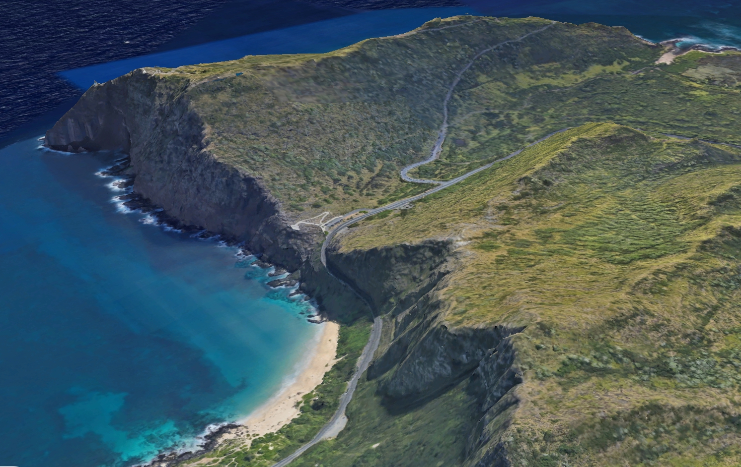
The photo above, courtesy of Google Earth, shows Kalaniana`ole Highway as it drops down into the southern part of Waimanalo, above Makapu`u Beach. In the early days, the road was a steep trail down the cliff and horses had to be walked, not ridden down it.
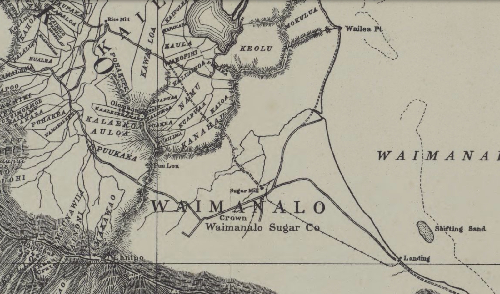
Finally, one last map below, from 1902. Not only does this map show the old route up and over Aniani Nui ridge, but it also depicts what appears to be a trail between Waimanalo and Lanikai around Wailea Point. The Hawaiian name for Wailea Point was Popo`oka`ala.
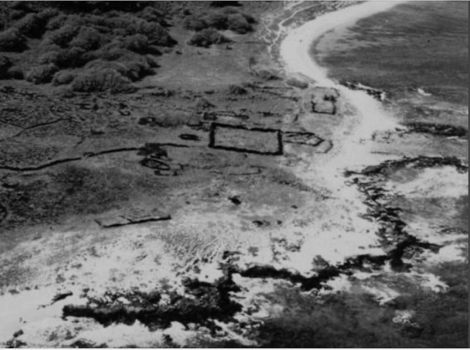
In conclusion, prior to the Kalaniana`ole Highway being built, there seemed to be three rather challenging ways in and out of Waimanalo. One could drop down the steep trail above Makapu`u Beach into Waimanalo. One could travel through Maunawili and up and over Aniani Nui Ridge. Or one could walk through Lanikai and around Wailea Point into Waimanalo. There is also, of course, another way, by sea. The photo below shows the remains of an ancient Hawaiian fishing village in Waimanalo, known as Ko`onapou. There was a canoe landing there, which can be seen in the middle right hand side of the photo.
Next time you drive in and out of Waimanalo, try to imagine what it was like getting there before Kalaniana`ole Highway was built! One last thing, Prince Jonah Kuhio Kalaniana`ole, who the highway was named after, was an original member of the Hawaiian Trail and Mountain Club.