Kuaokala
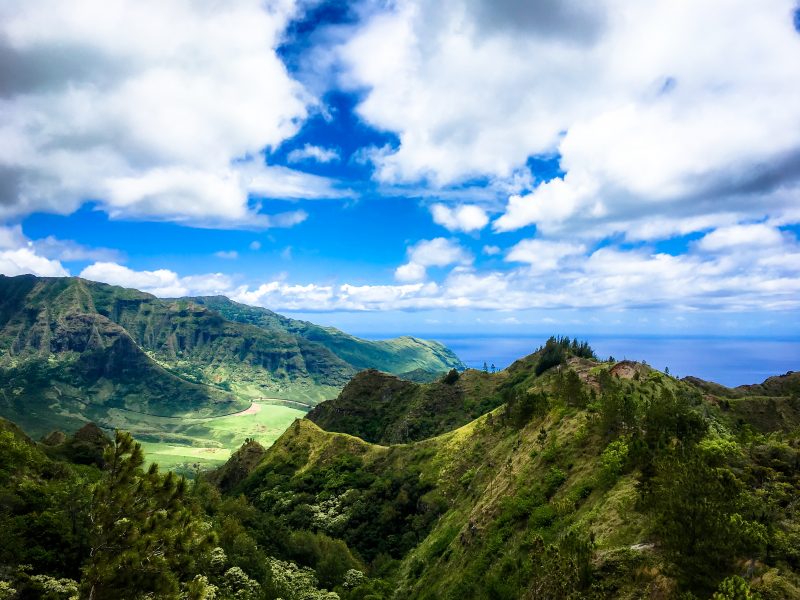
The majority of the elevation gain is by car, driving up a narrow military road to those mysterious “golf balls” above Yokohama Bay. From there, a relatively level trail follows the Makua Valley rim, with beautiful views into the valley and along the Wai’anae coastline.*
Reservation required to attend. The sign up period has ended. This hike is offered annually, check the schedule to join future hikes. Mahalo!
Limited to 35 people.
Cumulative Elevation Gain: 1,200 ft.
Trail Conditions: Steep drop-offs, narrow trail, slippery when wet.
Trail Features: Scenic views, native plants, sugi pines.
Trail Route: Out and back.
Native Plants: Ohia Lehua (red and salmon) and ko’oko’olau (native bidens).
Moku & Ahupua’a: To the south, Wai’anae & Keawa’ula and Kahanahaiki ahupua’a, to the north Waialua & Ka’ena.
Hawaiian Name Meaning: Literally, the back of the sun (kua = back, la = sun). West is where the sun sets (komohana).
A $5 donation is requested for each non-member, age 18 or over.
* The club takes no responsibility and disclaims any liability for the contents of hike descriptions including any inaccuracies, omissions, errors, misleading statements, incompleteness, or incorrect information (click here to read our full disclaimer).
Reservations are required. Limit of 35.